JACKSONVILLE, Fla —
What we're tracking:
SATURDAY:
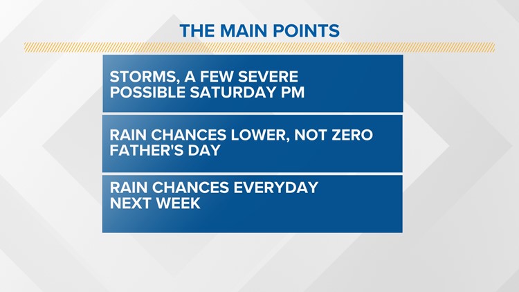
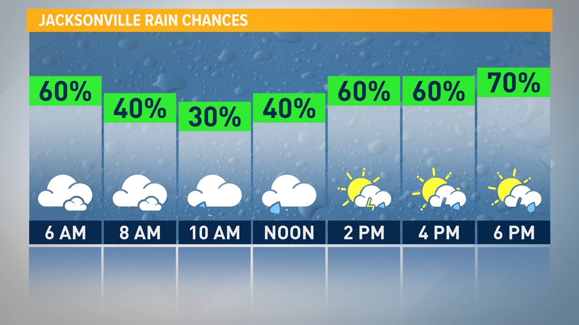
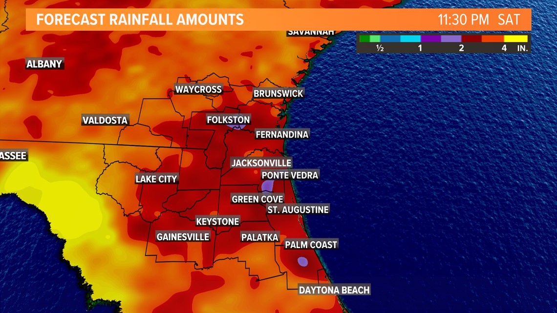
It would be a good idea to keep an eye on the forecast today. Rain chances will remain elevated for much of the day today thanks to our weather pattern across the region. As we head into the afternoon and evening, severe weather will be included in the mix too.

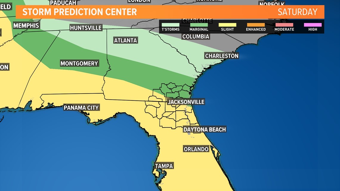
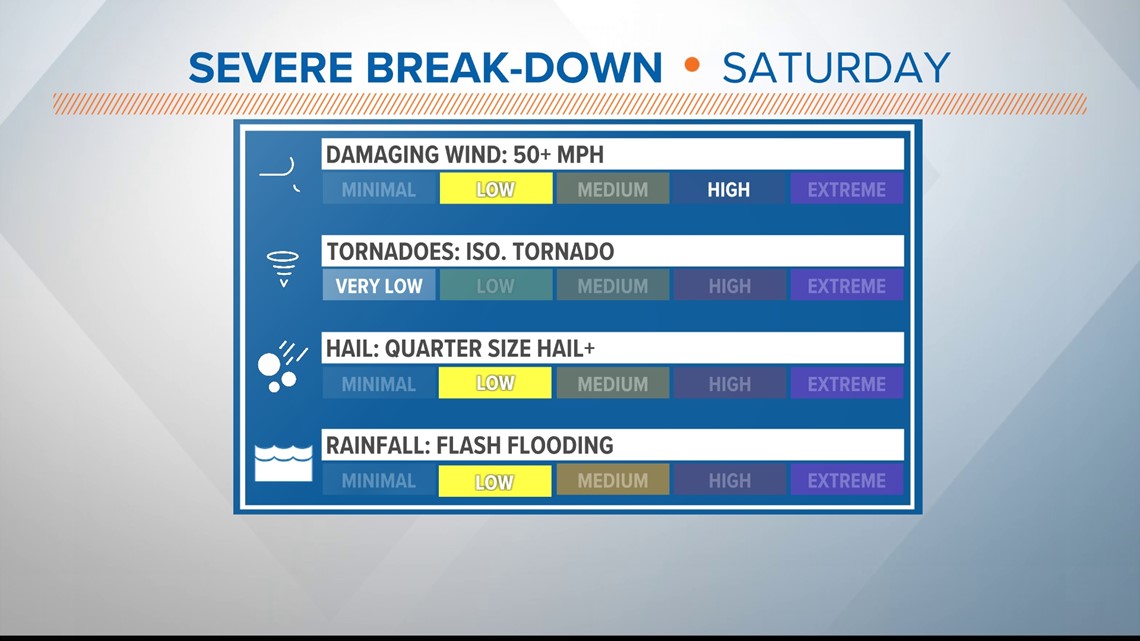
As of Saturday morning, the Storm Prediction Center has highlighted areas of FCN under a slight risk for severe weather. This is nothing new as active weather has been part of the forecast for the past few days and will continue for several more days.

Any thunderstorms that develop later this afternoon and into the evening hours will have the opportunity to become severe.
If a thunderstorm becomes severe, wind and/or large hail will be the main concern.
An isolated tornado cannot be ruled out but the threat will be very low and focused mainly for areas along I-75 and west.

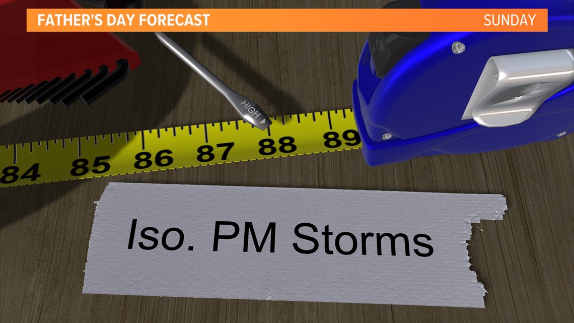
FATHER'S DAY: As we head into Father's Day it won't be a washout forecast.
Rain chances will stay low for much of the daylight hours. It won't be until we head into the evening when scattered showers and thunderstorms develop.
A strong thunderstorm cannot be ruled out but the severe weather risk will be low.

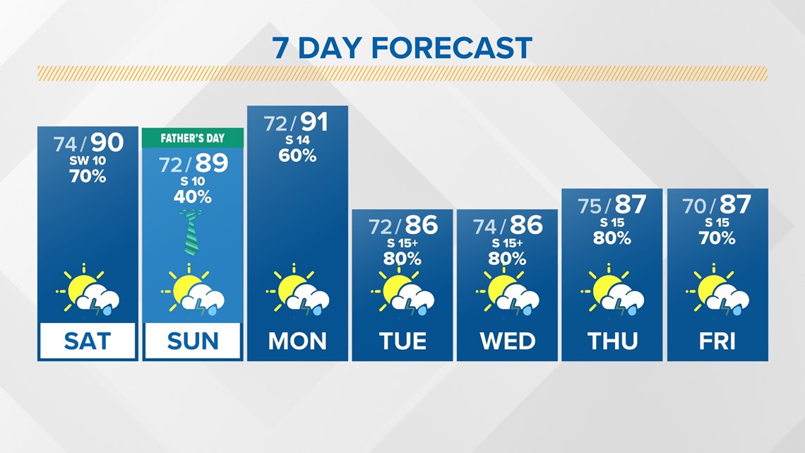
NEXT WEEK: Monday will be unsettled with heavy rain expected across the First Coast. In fact, thunderstorm chances stay elevated in the week ahead.
With all this wet weather in the forecast, rainfall totals will likely be generous. At this time, 7-day rainfall estimates have the FCN area seeing anywhere from 2-4 inches with isolated 4"+ totals.

Temperatures will cool some thanks to cloud cover and a frontal boundary in the area. High temperatures on Tuesday and Wednesday should peak out in the middle 80s.

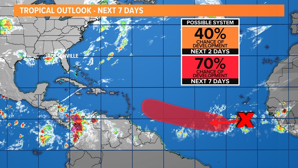
TROPICS: There are no tropical threats to us for the next 7 days. A tropical wave continues to move east off the west coast of Africa. It has a 70% chance of development over the 7 days. Check out our tropical updates here.

-----------------------------------------------
First Coast News Weather Watchers - Thank you for your photos and videos reporting weather conditions around the area. If you aren't a part of the group, you can ask to join here. We love sharing your pictures in our weathercasts! You are our eyes and ears across the region, after all.
----------------------------------------------------
If you missed our annual hurricane special, you can catch it here on YouTube. This year, we're hearing from our neighbors in "Hurricane Ready 2023: It Only Takes One."