
ST. AUGUSTINE, Fla. — Hurricane Ian made landfall on Wednesday afternoon as a very dangerous storm system before downgrading to a tropical storm Thursday morning. Watch live coverage from First Coast News.
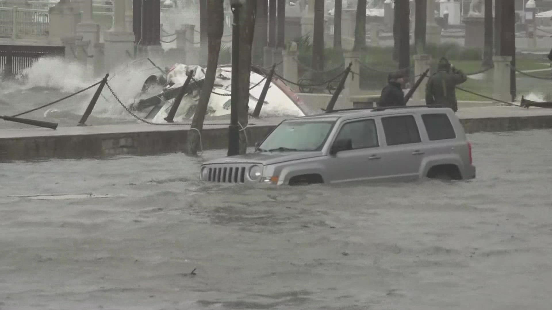
As Ian moved across the state Thursday, the First Coast quickly felt the impacts. Weather conditions in St. Augustine quickly deteriorated throughout the morning and by Thursday afternoon, the city had experienced "significant flooding."
According to St. Johns County Administrator Hunter Conrad, the county continues to see sustained winds between 30 and 50 mph, with gusts a little higher.
Residents are asked to be patient and continue sheltering in place.
"From a fire rescue standpoint, this is still an extremely dangerous storm," said St. Johns County Fire Chief Jeffrey Prevatt. He added that the department has already made multiple rescues today.
"We’re having to use a lot of high water vehicles to get people out of their houses, especially in the evacuation zones where residents didn't evacuate," he said.
While the Bridge of Lions remains closed (pedestrian traffic permitted), all other bridges remain open, Conrad said.
"The wind speeds have not been such that we’ve had to shut down the bridges, so the bridges do remain open, but the Bridge of Lions is closed," he said. "That’s because of the storm surge."
As the storm moves across the state and exits into the Atlantic, First Coast News Meteorologist Robert Speta said counties along the coast will need to watch for a dangerous storm surge as the storm kicks back into the Atlantic.
"Tropical storms can still produce a storm surge," Speta said. "Two to four feet along our coastal areas."
"At this point from a flooding standpoint I would consider it pretty close to Matthew," Prevatt said. "We’re seeing some flooding this time in places different from what we’ve seen before."
Prevatt added that the situation is getting better as the day goes on.
Conrad said it's possible that St. Augustine has already seen its storm surge peak with high tide earlier Wednesday afternoon.
Officials are also asking residents in the county to avoid traveling on roads as much as possible as first responders work to reach the hardest hit communities.
One area in particular that the First Coast News weather team is keeping a close eye on is San Marco, an area that is prone to flooding during a regular rain event.