
JACKSONVILLE, Fla. — Part of preparing for a hurricane is knowing what the forecast means for you and your area.
Let’s start with watches and warnings. Do you know the difference?
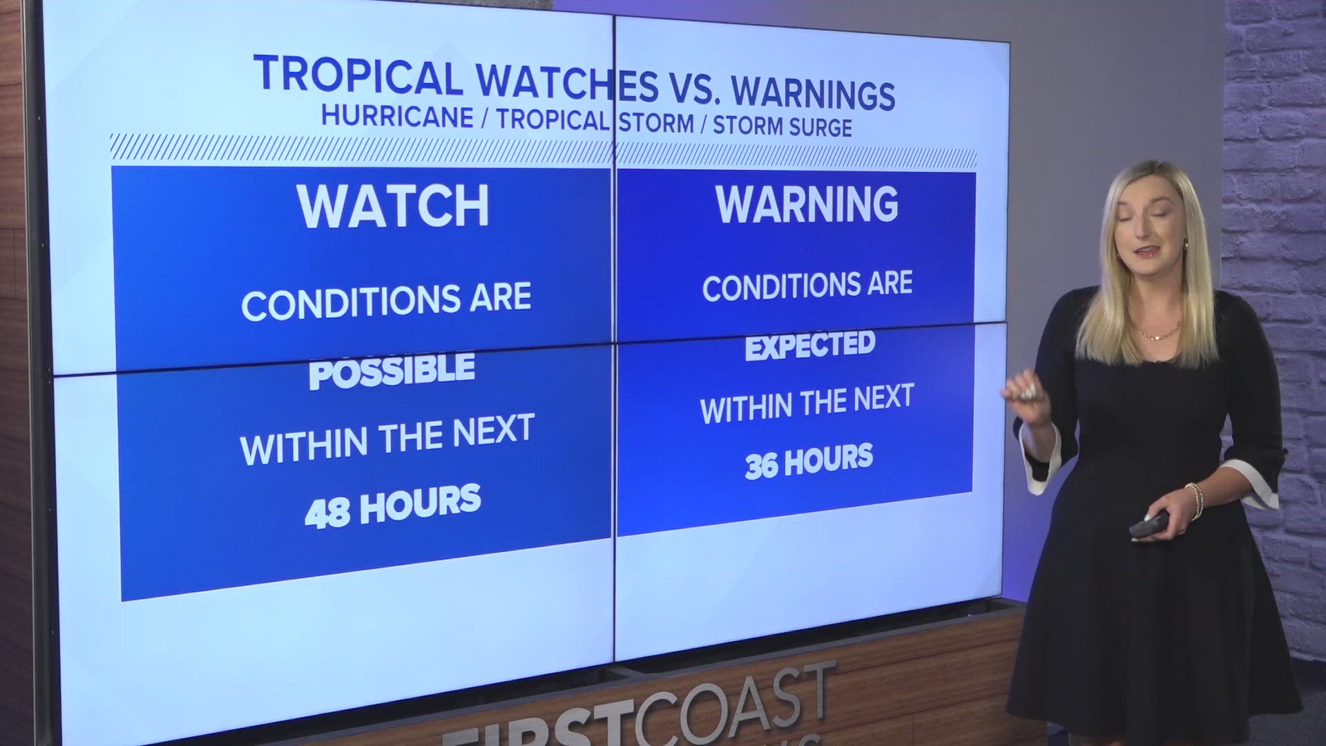
Generally, a watch means conditions are possible within 48 hours, and a warning means conditions are expected within 36 hours.
For example, tropical storm watch means tropical-storm-force winds (39 to 73 mph sustained winds) are possible within 48 hours, but a tropical storm warning means they are expected within 36 hours. A storm surge watch means there is the possibility of life-threatening inundation within 48 hours, but a warning means there is danger from life-threatening inundation within 36 hours.
Hurricane watches and warnings are a little different. A watch means hurricane conditions (74 mph sustained winds or higher) are possible, and it is issued 48 hours before the expected onset of tropical-storm-force winds in an area. A warning means hurricane winds are expected and is issued 36 hours before the arrival of tropical-storm-force winds. They are issued based off of tropical storm conditions because preparation for a hurricane becomes difficult once winds reach tropical storm force, so issuing the watches and warnings ahead of the arrival of those winds will allow more time for hurricane preparation.
Some other watches and warnings to touch up on include:
Extreme Wind Warning: Hurricane winds of 115 mph+ or stronger are imminent or happening, and one should seek shelter in an interior room away from windows or outside walls
Flood:
- A Flood Watch means flooding is possible
- A Flood Warning means flooding is happening or about to happen and one should move to higher ground immediately
- A Flash Flood Warning means dangerous flash flooding is expected. Move to higher ground and never walk or drive through floodwater.
- A Flash Flood Emergency is issued when there is a severe threat to human life and catastrophic damage is happening or about to happen.
Tornado:
- A Tornado Watch means a tornado could possibly develop, so know where your safe place is and be ready to act quickly if a warning is issued
- A Tornado Warning means a tornado is happening or about to happen, so seek shelter immediately
Besides knowing the difference between watches and warnings, it’s important to know what other forecast products mean for your threat level.
Focus on all hazards from a storm, not just its category or size. Water is the #1 killer in hurricanes, but hurricane categories are only based off of wind speed. Life-threatening flooding could occur from a category 1 hurricane, so it is important to never write off a storm based on its category and instead look at all the possible impacts (storm surge, rainfall flooding, damaging winds, tornadoes and rip currents).
Remember that deadly hazards can happen outside of a forecast cone. The cone only shows where the center of a storm could go, but the storm itself could be much bigger than the cone. As forecasting the path of a storm has become better over the years, the cone has become narrower. That means strong, dangerous bands of a hurricane could swing well outside of the cone. It also means life-threatening inland flooding and storm surge could occur away from the cone. Just because the forecast cone doesn’t pass over your town doesn’t mean you won’t be impacted.
Hurricane season begins June 1 and it is expected to be an active season. Stay with the First Coast’s Most Accurate Weather Team to stay updated this season.