

The earthquake in Turkey and Syria was powerful, and images of the damage there show just how of a severe impact was felt. But a scan from the satellite ALOS-2 from the Japan Space Agency in collaboration with NASA really shows how much land moved during the quake.
It indicates that some areas along the fault line in Turkey moved upwards of 5-6 feet of pure land movement and deformation. This is why the shaking lasted so long and was so intense for the hardest hit areas.
The areas in blue and red on the image below shows land that moved upwards of 2 meters or 5-6 feet to and away from the satellite versus what the satellite seen on previous passes over the area.


It gets this data by sending pulses of microwaves towards the earths surface and listens for reflections to map the landscape. Then they simply compare the images before and after the quake to get the change.
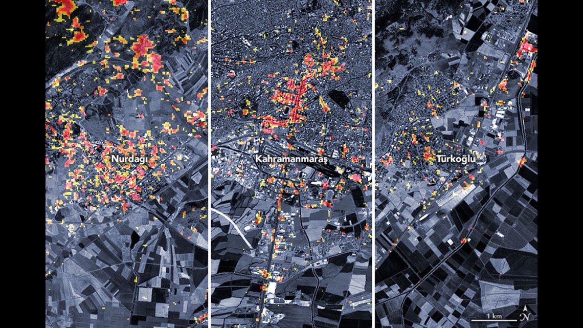
This not only shows land change, but also damage to buildings based on how the imagery returned a difference from a satellite pass in April of 2022. The image below shows the extent of the damage to buildings in the hardest hit cities. The red indicating a noticeable change in building structure. Which can be inferred as damaged buildings and possible collapses.

This took also can be used to show what areas are at highest risk of landslides as aftershocks continue to rattle the area.