JACKSONVILLE, Fla. — The forecast “cone of error.” We all have seen this before and know it is associated with tropical systems. But did you know it was not until July 14th, 2002 that the National Hurricane Center officially started putting out a forecast using the cone?
That was with Tropical storm Arthur, a relatively weak storm that impacted the Canadian Maritimes, but it was the first warning to use this product.


Behind the scenes, the NHC and meteorologist were using graphics like this for years, and even the Japan Meteorological Agency was using a cone of error style graphic since the 50s for warnings on typhoons.
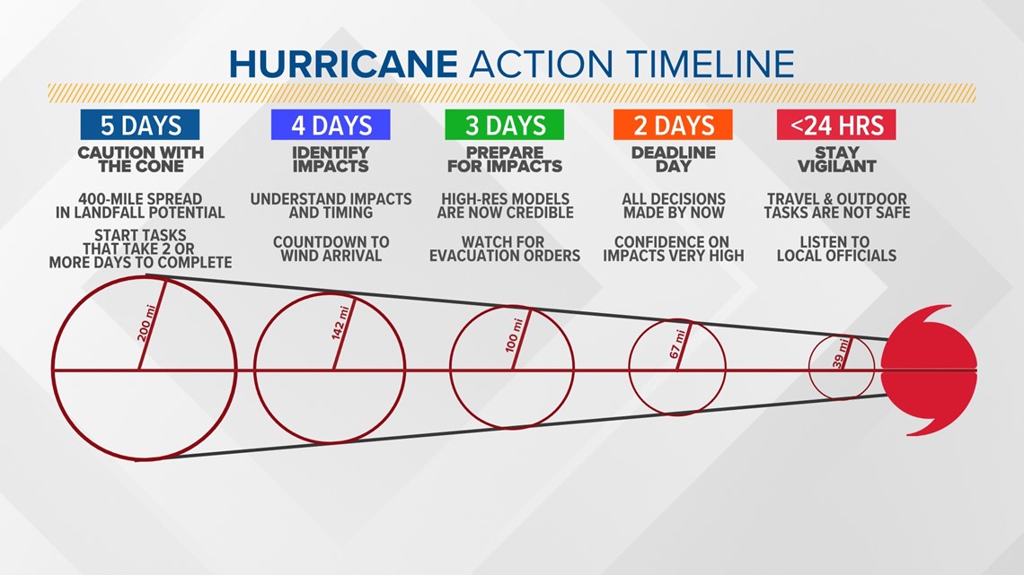
It’s important though to remember the cone of error is just that, a cone showing the possible track the center of the storm could take and not the scope of the storm itself. It’s important that impacts can be felt well away from the center and even outside of the cone of error. The point is always pay attention to the details of a forecast and check in for the newest updates when they become available.