
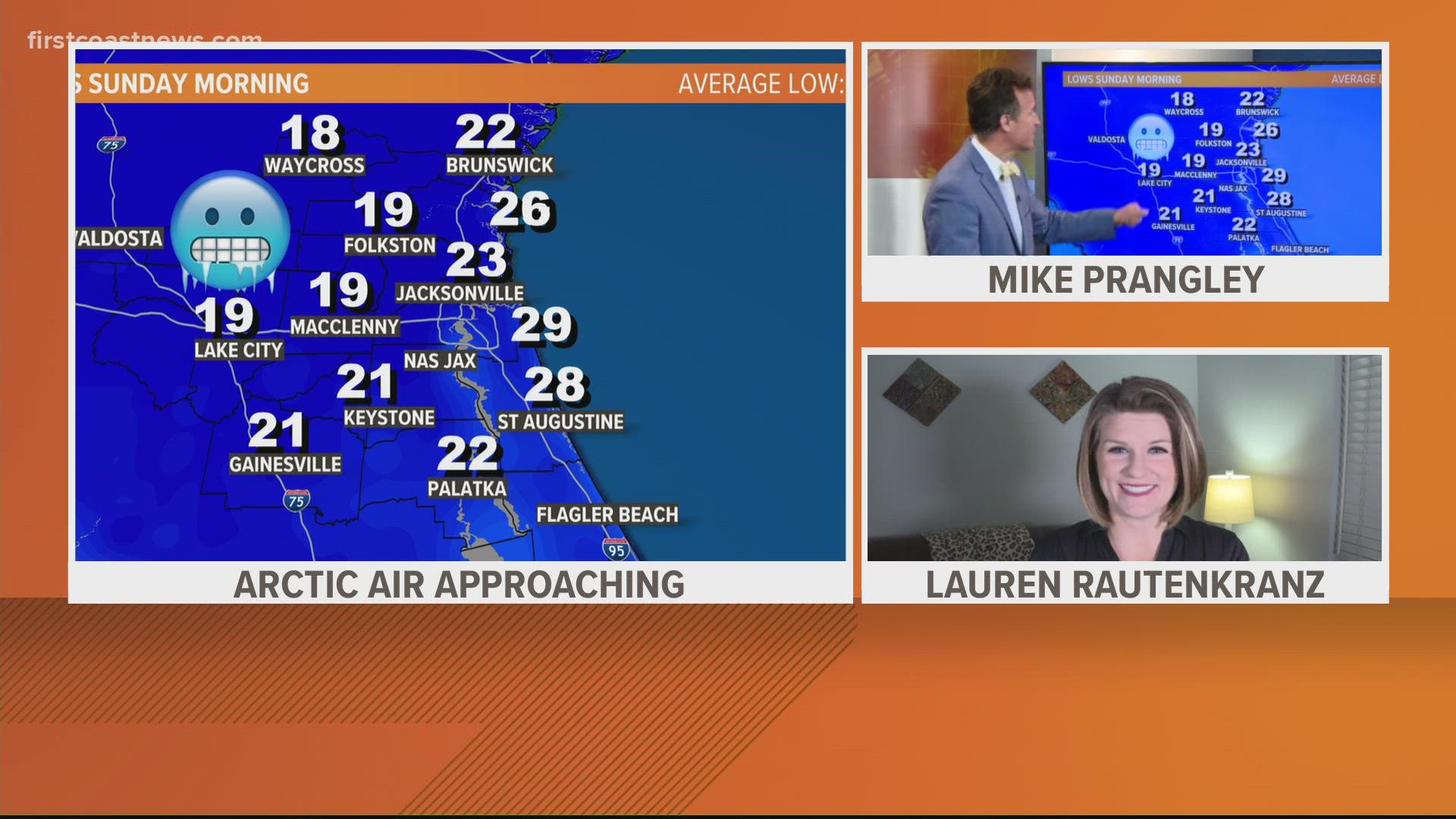
JACKSONVILLE, Fla. — We've been talking about the cold pattern to end off the month of January for weeks now. It's not just going to be cold this weekend. It's going to be windy, and that is a recipe for some very frigid wind chills for Jacksonville!
Similar to how we measure heat index with warm weather, wind chill is a term used to describe what the air temperature really feels like to the human skin. Wind chill is due to the combination of cold temperatures and winds blowing on exposed skin.
Simply put, the colder the air temperature and the higher the wind speeds the colder it will feel on your skin if you're outside. It could be a plain ol' 30F with no wind, but if you increase the wind speed with that same 30F it will actually feel colder to your skin.
The reason is because as wind blows across our bodies it takes the heat we naturally emit and blows it away from our bodies. Hence, a wind chill. The faster the wind speed the faster our body heat is taken away and the colder it feels to us. It is a similar process for when you blow on a hot bowl of soup to cool it down.
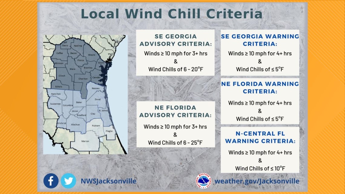
The National Weather Service will issue advisories or warnings if wind chills threaten. Each office across the country has different criteria. The following is how the NWS Jacksonville office determines a Wind Chill Advisory or Warning for southeast Georgia and northeast Florida:

Just like we talk about the dangers of summertime heat, the combination of wind and low temperature in winter can be harmful or even deadly, too. The wind chill index helps you determine when dangerous conditions develop that could lead to frostbite or hypothermia. The National Weather Service gives an example, "It takes into account heat loss from the human body to its surroundings during cold and windy weather. The calculation utilizes wind speed in miles per hour and temperature in degrees Fahrenheit. For example, a temperature of minus 5 degrees occurring with a 20 mph wind gives a wind chill near minus 30 degrees (see wind chill calculation table below). This means that your body will lose heat at the same rate as it would if the air temperature were minus 30 degrees with no wind. Wind chill values near minus 25 degrees mean that frostbite is possible within 15 minutes."
Frostbite is the freezing of skin and the body tissue just beneath it. It first affects exposed body tissue where blood circulation may be limited such as your fingers, toes, nose and ears. To minimize frostbite, make sure all body parts are well covered.
Hypothermia is a dangerously low body temperature and is the most common winter weather killer. When you hear of a hiker, climber, hunter, or a stranded traveler perishing from cold weather exposure, hypothermia was the cause. Most people are surprised to learn that hypothermia deaths can occur with temperatures between 30 and 50 degrees. If you or tour clothing are wet, then hypothermia becomes even more likely.
Warning signs of hypothermia include uncontrollable shivering, memory loss, disorientation, slurred speech, and drowsiness. Immediate medical attention should be given to victims suspected of suffering from hypothermia. If no help is available, the victim should be warmed slowly with warm liquids along with dry clothing and blankets.
Stay warm this weekend, friends!