JACKSONVILLE, Florida — "It's hard not to be excited," said Tim Deegan. "If there's a flake, talking about a snowflake, anywhere in North America Mike Prangley's going to find it."
No one loves winter more than Mike Prangley, growing up in the northeast some of his best memories are of snow.
"Ah, there's too many to remember," said Prangley. "I always loved shoveling snow at my Grandfathers and then coming in for his home cooking."
And let's be honest, where would we be without Prangley? His bright bow-ties and smile get us through the mornings each day on #GMJ. A great meteorologist, not only in the short term forecasts but in the long-range as well.
"Our winter in three words; blustery, frosty & stormy," said Prangley.
So as we approach his favorite time of year, the First Coast Storm Experts would like to share his outlook on the upcoming winter season.
There are many factors and elements that come into play when putting together a seasonal outlook. Here are the top five that will give us an energetic and active winter season.
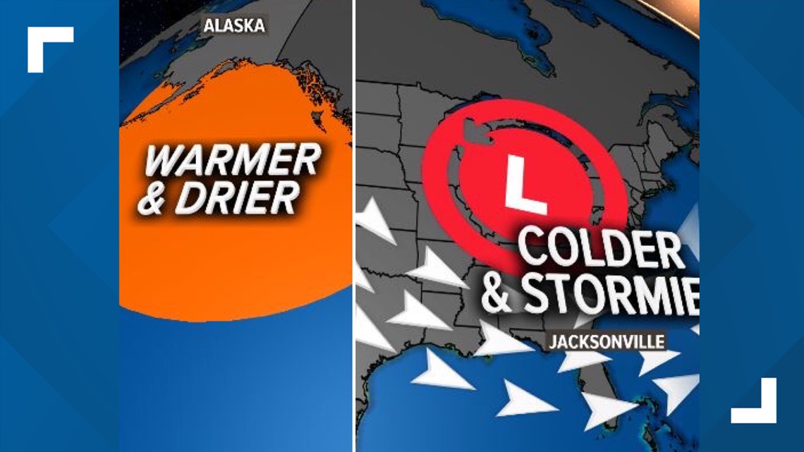
Warm Blob: The blob is back! No, it's not the remake of the 1958 horror movie, it's an area of warm water in the Gulf of Alaska. This creates more frequent ridging along the West Coast. And where one side of the country's weather is up, the other side is down. Giving the eastern United States more frequent shots of cold, winter air, and a more active storm track.

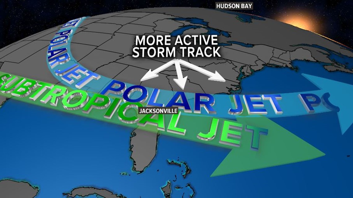
Tale of Two Jet Streams: This winter we are anticipating a more active Polar Jet Stream and Subtropical Jet Stream. More activity and energy from both of these give the First Coast those classic roller coaster rides of weather. More frequent blasts of cold & warm air, fronts dropping in, soaking rains and severe weather.

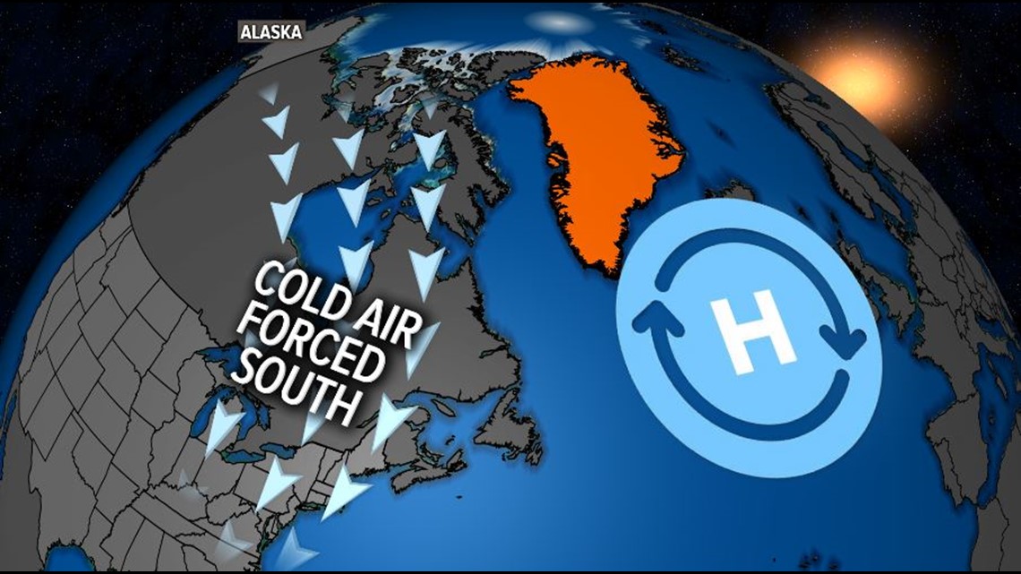
Sven in Greenland: When it comes to the winter outlook, Mike Prangley means business. He doesn't just look within the United States, but around the globe. So when the snow in Greenland starts melting, we along the First Coast start freezing. A big, blocking area of high pressure up near Greenland (which brings warmer weather there) forces colder, polar air south into the United States.

Anchovies in Peru: Our winter weather can be linked to how many fish are being caught off the coast of Peru. Yes, you hear that correctly. This season, there hasn't been an El Nino in the Pacific. Trade winds shift the warmer waters near South America west, bringing the cold, nutrient-rich waters to the surface. Gives fishermen off the western coast of South America a better season and us locally, more access to cooler air.
Solar Minimum: Storms on the sun will determine how often we bring in our plants this winter. The bright, fiery star in the center of our solar system is in a solar minimum, meaning fewer 'solar storms' on its surface. This is often linked to cooler periods on Earth.
Will it snow across the First Coast this winter?
"Yes!" exclaimed Prangley, who is anticipating snow flurries in Jacksonville at some point this winter. Climatology says Jacksonville averages snow flurries every six years, and this winter is looking similar to the patterns of the 2014/2015 season, where snow flurries fell downtown.
So those who love snow, or who have never seen a snowflake, this winter may be your chance!