To truly grasp the scope of Hurricane Michael's fury, look no further than a bird's-eye view.
NOAA's Remote Sensing Division published a Google Maps-like website late Thursday with imagery up and down some 200 miles of coastline on the Florida Panhandle.
Users can zoom into the map for a street-level view. On the far west end of the Panhandle, Pensacola Beach looks untouched as people enjoy the day in the water.
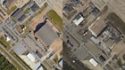
From Panama City Beach westward, however, the destruction becomes more apparent. The first bit of roof damage appears in this area.
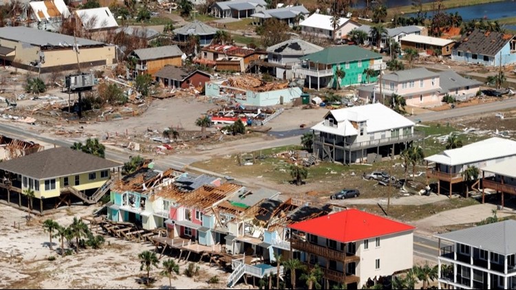
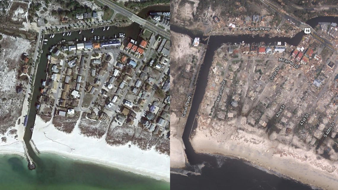
Farther west, the dirty mounds of a baseball field are no more having been blown off by the wind. Roofs are torn off at the nearby Air Force base. In Mexico City, not far where Hurricane Michael made landfall as a 155-mph, Category 4 storm, buildings clearly were wiped from their foundations.
In this area, a combination of wicked winds and a 9-foot storm surge led to the catastrophic damage.
Damage in Mexico Beach, Florida

Damage at Tyndall Air Force Base