
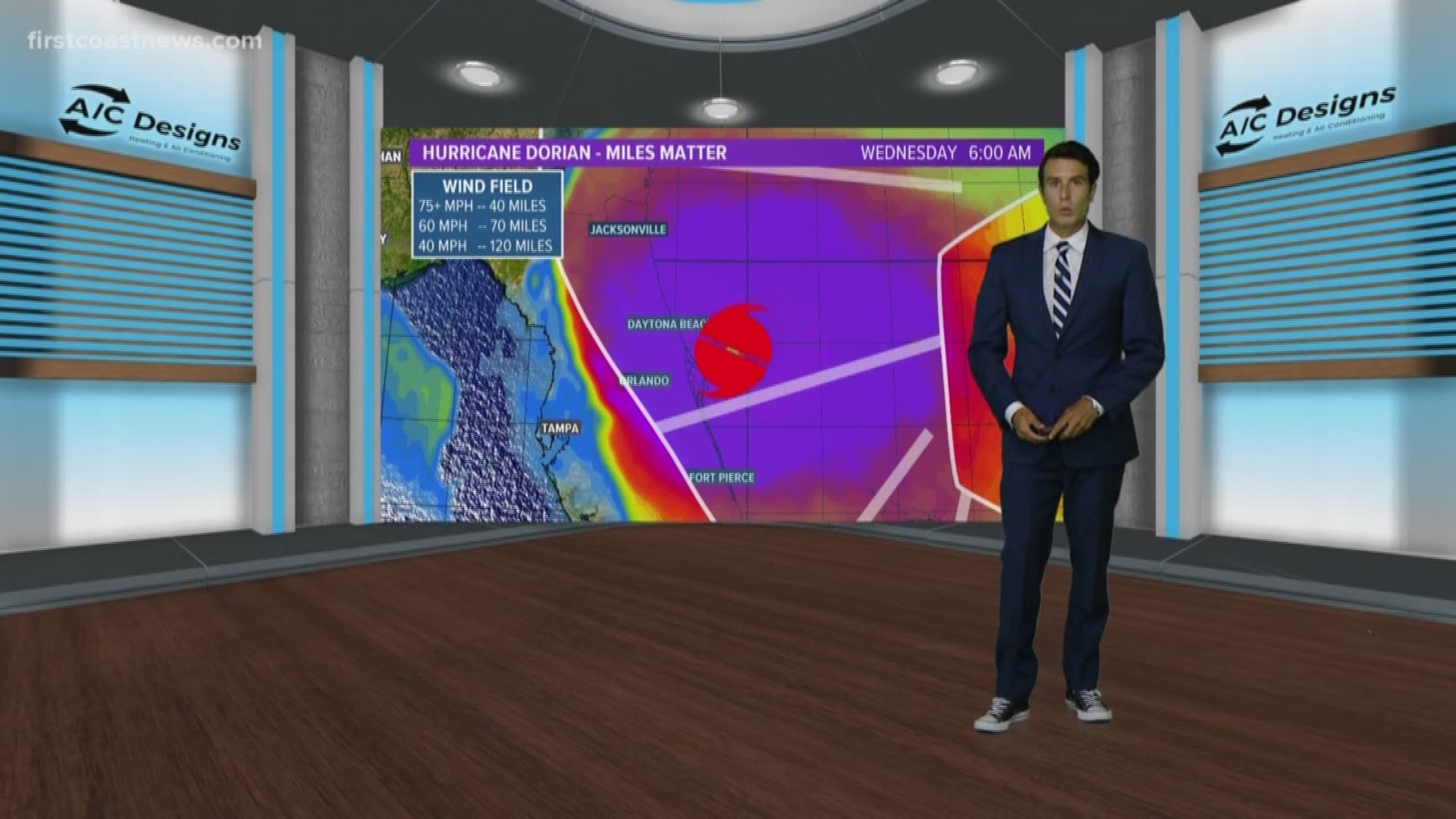
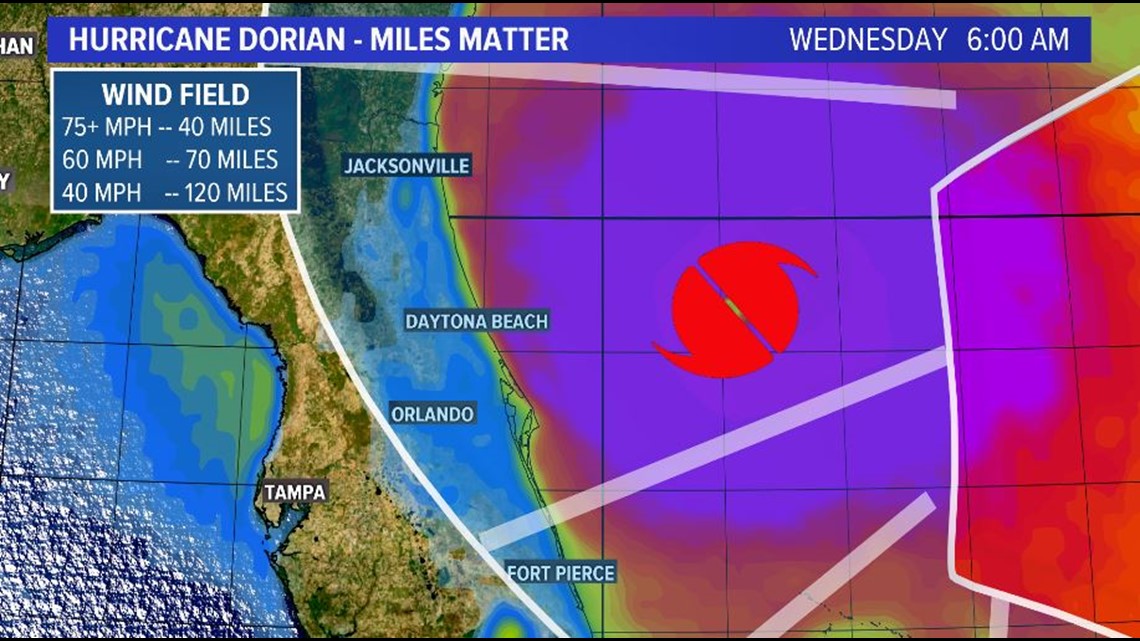
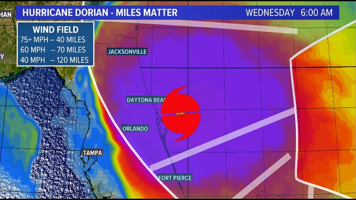
The northern turn of Hurricane Dorian is on many of our minds with the question, "How close will it be to Florida?" There have been positive trends lately that may keep Dorian's eyewall, the most powerful part of a hurricane, offshore. But how far offshore is the next question. A difference of just a few miles will mean a big difference to our local weather.
Miles matter
The next critical part of Dorian's forecast is the turn to the north, which will happen on Labor Day. While we are liking the positive trends of a more easterly track after the turn, most of the First Coast remains in the cone of uncertainty. Slight shifts by only a few miles could add up to a big difference.
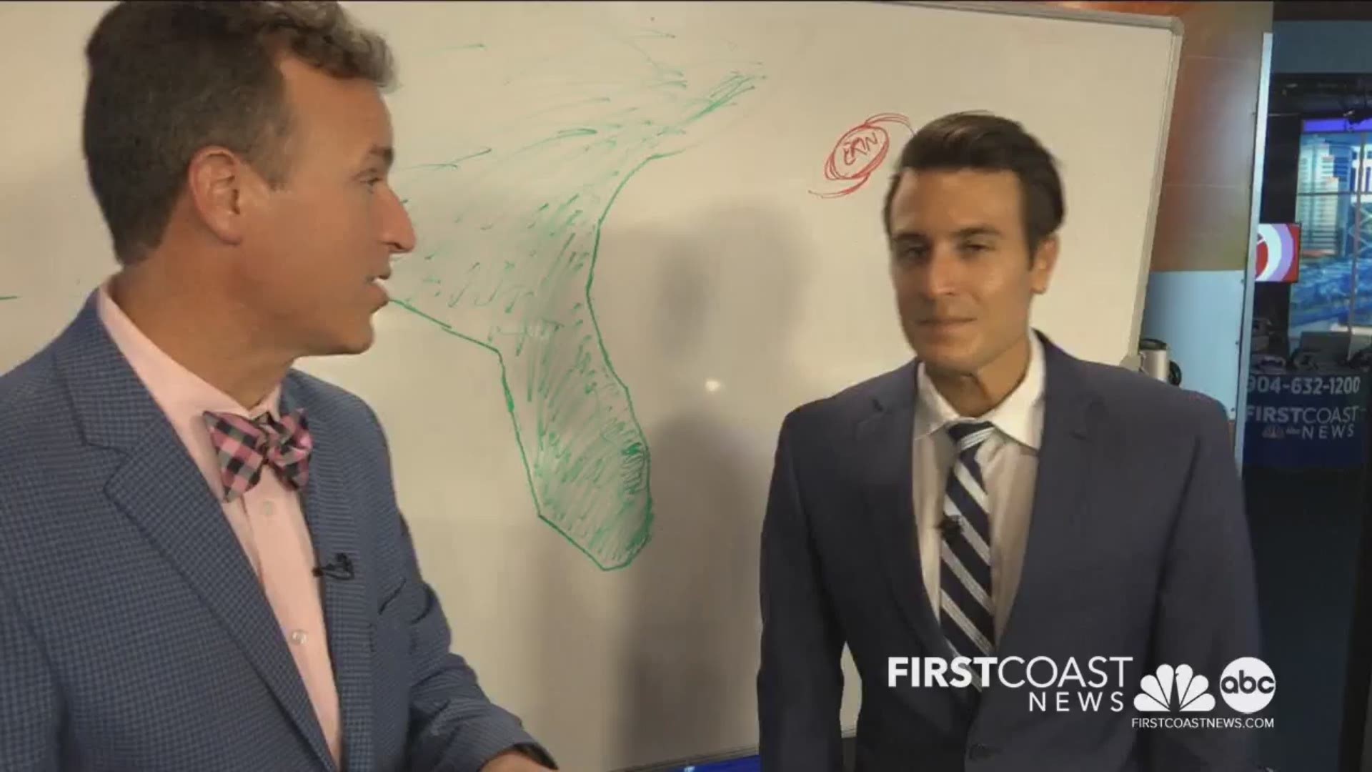
Why the eastern shift?
Meteorologists Mike Prangley and Steve Fundaro discuss the variables affecting Dorian's expected northern turn, and how some are hinting at an easterly trend.
There still remains plenty of uncertainty in Dorian's future track, please stay locked into the forecast and updates.