JACKSONVILLE, Fla. — Irma.
The name perks up ears across Jacksonville and there's no doubting why.
Hurricane Irma was responsible for one of the worst flooding events in the River City's 225+ history. On top of the high waters, northeast Florida experienced hurricane-force wind gusts and a few tornadoes causing damage to homes and businesses, along with widespread tree and power line damage.
In August of 2017, a tropical wave moving off the west coast of Africa quickly proved it was a force to be reckoned with. It became a tropical storm on August 30th gaining the name Irma.
Irma quickly gained hurricane status and rapidly intensified to a category 3 storm in just 30 hours. By September 4th, Irma was a category 4 hurricane. Just the next day it was a category 5.
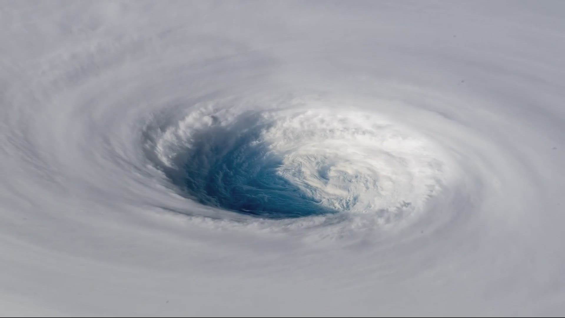
With maximum sustained winds of 185 miles per hour, Irma became the strongest storm on record to exist in the Atlantic Ocean outside of the Caribbean and Gulf of Mexico. It broke the record for the longest of any cyclone in the world since 1932 to maintain that intense of winds -- for 37 hours straight and it spent three consecutive days as a category 5 hurricane.
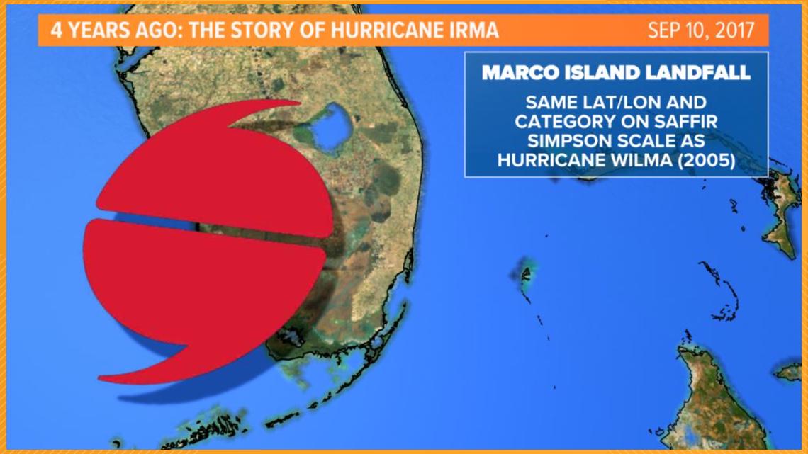
Irma had seven total landfalls from September 6th through September 10th.
- September 6: Landfall on Barbuda
- September 6: Landfall on St. Martin
- September 6: Landfall on Virgin Gorda, British Virgin Islands
- September 8: Landfall on Little Inagua, Bahamas
- September 9: Landfall near Cayo Romano, Cuba
- September 10: Landfall on Cudjoe Key, FL (the first major hurricane to hit Florida since Hurricane Wilma in 2005)
- September 11: Landfall near Marco Island, FL
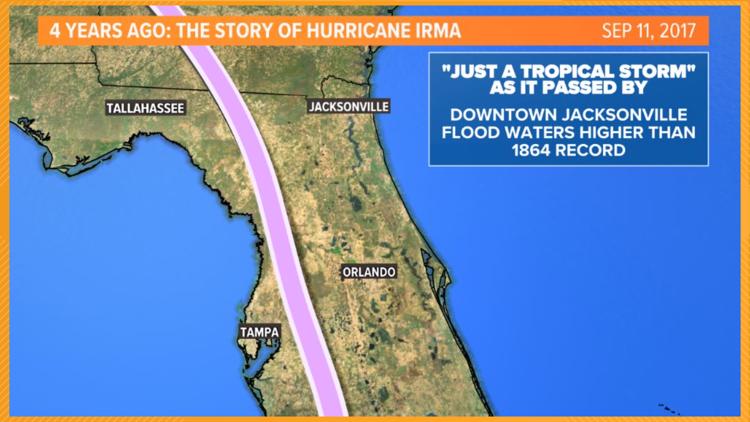
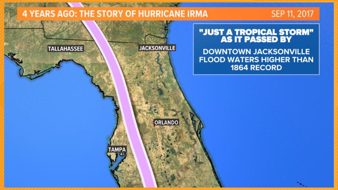
- 2:00 a.m. Irma passes between Tampa and Orlando as a category 1 storm
- 8:00 a.m. Irma "weakens" to a tropical storm about 20 miles west of Gainesville
- 2:00 p.m. The storm's center moves over south Georgia just west of Valdosta


"The occurrences of Harvey and Irma, making landfall within two weeks of each other, were the first time in recorded history that two category 4 or higher hurricanes struck the U.S. mainland in the same year," according to NOAA.

Irma passed Jacksonville as "just a tropical storm" but brought significant impacts to the First Coast.
On top of the nor'easter event already backing up the St. Johns River ahead of this approaching system, the heavy rains and surge from Irma added up to historic flooding in the area. Flooding was reported on gauges at most of the rivers in northern Florida. Even major or record high water levels were reported at rivers across Bradford, Clay, Marion, Flagler, Duval, Putnam, St. Johns, Nassau, and Alachua counties.
"The St. John’s River set record flood stages at many locations in Duval County, causing major flooding in the Jacksonville metropolitan area, where hundreds of people were rescued," according to the National Hurricane Center's Tropical Cyclone Report on Irma. "Similar flooding occurred in Bradford County where record flood stages were set at Alligator Creek, Hampton Lake, Lake Sampson, and New River."
Some people who experienced the storm said the flood waters came in fast and gave people who were in the area little time to prepare. The water rushed into the city's streets reaching 5 feet deep in some locations.
The report goes on to explain, "The [gauge] at the I-295 bridge on the south side of Jacksonville measured a peak water level of 5.3 ft MHHW, while gauges at Southbank Riverwalk in Downtown Jacksonville and at Racy Point recorded peak water levels of 4.9 ft MHHW and 4.0 ft MHHW, respectively."
"As an illustration of the combined effect of storm surge and rainfall runoff, observations from a USGS station in downtown Jacksonville showed that salinity within the river gradually increased from less than 5 parts per thousand (ppt) on 8 September to about 30 ppt (just a little less than the average salinity of the ocean) late on 10 September. These data indicate that the initial water rises were likely due to easterly winds ahead of Irma pushing seawater upstream in the St. Johns River."
"However, the USGS data then showed salinity decreasing rapidly back to normal levels at the downtown site on 11 September, while the water level at the site continued to increase and reached its maximum about six hours after the salinity peak. This suggests that the freshwater input from rainfall runoff was also a significant contributor to the flooding that occurred along the St. Johns River."
Impacts were felt across southeast Georgia as well. Major flooding was seen in St. Simon’s Island and along the Satilla River. Rainfall totals checked in between 5 and 10 inches for coastal Georgia, with the highest rainfall amount for the state of Georgia as a whole measured in Nahunta in Brantley County of 10.34 inches.

Irma is just another example of why meteorologists urge folks to NOT focus on the cone alone. Impacts from tropical systems stretch far outside of where the center of a storm tracks. This is why it's critical to stay tuned to updates and Jacksonville's Most Accurate First Coast News Weather Team as we break down what you can expect across the area neighborhood by neighborhood.