
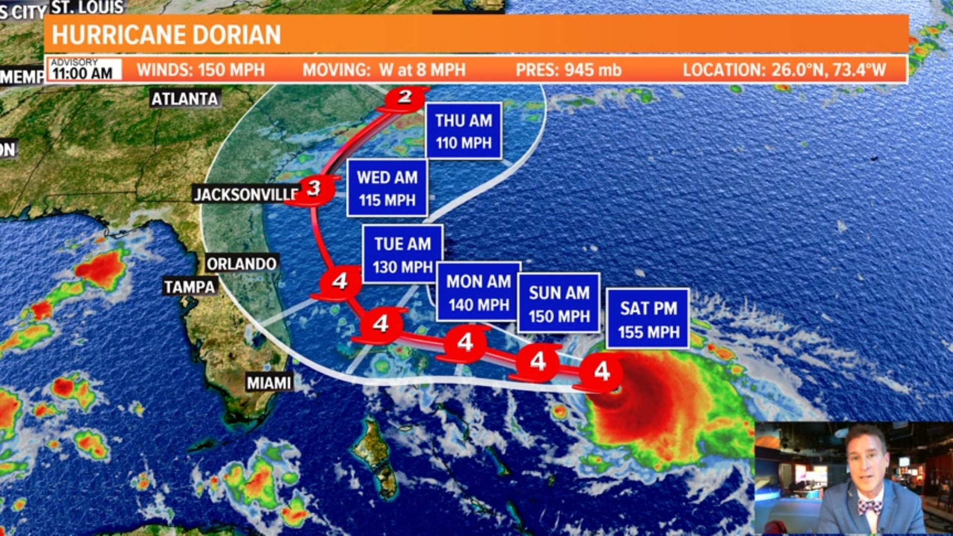
As of Saturday 11 a.m. update from the National Hurricane Center:
What category is Hurricane Dorian?
Latest observations from Hurricane Dorian show the storm stronger, now a Category 4 hurricane with maximum sustained winds of 150 mph. This very powerful storm is expected to remain powerful and also expand in size in the coming days.
Where is Hurricane Dorian?
About 450 miles east of West Palm Beach, Dorian's minimum central pressure is 945 mb. It's moving towards the west at 8 mph towards the Sunshine State. There is more confidence in a turn to the north and east of Florida.
Why do you need to keep checking back if it is moving east of Florida?
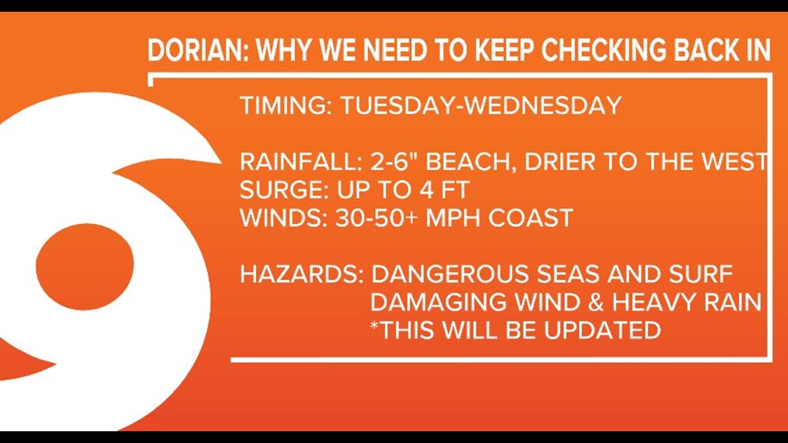
The current National Hurricane Center forecast has Dorian remaining off the shore of Florida but gusty winds and showers will increase locally as it skirts to our east by late Tuesday and Wednesday.
Recent trends give us plenty of time to monitor the forecast and locally, our holiday weekend weather isn't all that bad to prepare.
Why do we need to stay prepared and check back in on this holiday weekend?
Most of the models now shift Dorian east of Florida but we do need to check back to make sure this trend continues. Make sure to stay prepared. Right now we are still in the wait and see mode. But the trend is our friend for now.
What impact will Dorian have on Florida and Georgia?
After making a move north this weekend offshore Florida there will be concerns for rip currents, dangerous seas and beach erosion. We will also keep an eye on higher than normal tides. Right now impacts look to be greatest along the beach with gusty winds of 30-50 mph and 2-4" of rain but if the east trend continues we will have less of an impact.
Everyone along the Florida East Coast should keep their guards up and have a plan in place.
Stay locked into this forecast during the week because a lot can change. This forecast will be updated almost hourly.

FCN Storm Experts' Facebook: Tim Deegan, Mike Prangley, Lauren Rautenkranz and Steve Fundaro
FCN Storm Experts' Twitter: Tim Deegan, Mike Prangley, Lauren Rautenkranz and Steve Fundaro